
 မြန်မာဘာသာ
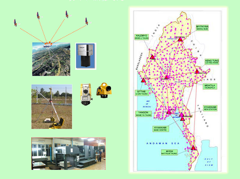
Introduction
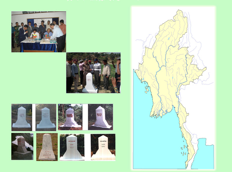
Survey Department mainly takes responsibilities for topographic mapping throughout the whole country and jointly carries out boundary demarcation works with neighbouring countries.
Background
From 1905 to World War II , under the British rule, all the surveying works of Myanmar were undertaken by the Survey of India. At the end of World War II, the British government separated surveying works of Myanmar from Survey of India. On 1st November 1946, Burma Survey Department was formed under the Ministry of Finance and Revenue by the British Government. On 1st March 1990, during the reign of the State Law and Order Restoration Council, Survey Department was formed with a new set-up consisting of six divisions:
Organizational Structure
On 1st March 1990, during the reign of the State Law and Order Restoration Council, Survey Department was formed with a new set-up consisting of six divisions:
(a) Office of the Director General
(b) Aerial Survey and Photography Division
(c) Map Reproduction Division
(d) Geodetic and No.(2) Survey Division
(e) International Boundary and Civil Construction Survey Division
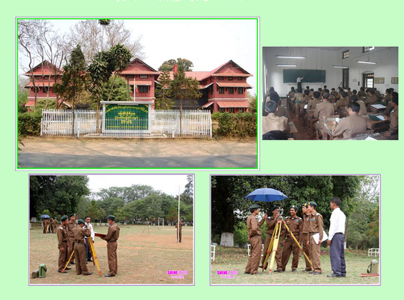
(f) Training and No.(1) Survey Division
Each division is under the supervision of a respective Director. Director General and Deputy Director General give necessary guidance to the Directors.

Set-up and Strength
Sanctioned strength of the Department has a work force of (90) officer ranks and (1395) other ranks, totaling (1485) staff members. Director General is the Head of Department. The following table shows the number of posted strength at the end of March, 2024.
|
No. |
Name of Division |
Officers |
Other Ranks |
Total |
|
1. |
Office of the Director General |
13 |
53 |
66 |
|
2. |
Aerial Survey and Photography Division |
12 |
62 |
74 |
|
3. |
Map Reproduction Division |
12 |
67 |
79 |
|
4. |
Geodetic and No.(2) Survey Division |
13 |
54 |
67 |
|
5. |
International Boundary & CivilConstruction Survey Division |
13 |
33 |
46 |
|
6. |
Training and No.(1) Survey Division |
12 |
80 |
92 |
|
|
Total number of staff |
75 |
349 |
424 |
66Objectives
There are three objectives in the Survey Department as follows:
(a) To produce topographic maps required by the nation
(b) To accurately demarcate the national boundary
(c) To train and nurture surveying technicians
Conclusion
The main objective of the Survey Department is to take responsibility for Surveying and Mapping in the nation. While trying to cope with the new technological developments, all the personnel of the Survey Department will do their best to fulfill the needs of the country.
