ပြည်ထောင်စုသမ္မတမြန်မာနိုင်ငံတော်အစိုးရ
သယံဇာတနှင့်သဘာဝပတ်ဝန်းကျင်ထိန်းသိမ်းရေးဝန်ကြီးဌာန
မြေတိုင်းဦးစီးဌာန
တိကျမှန်ကန်မြေတိုင်း“စံ”

 မြန်မာဘာသာ
 About
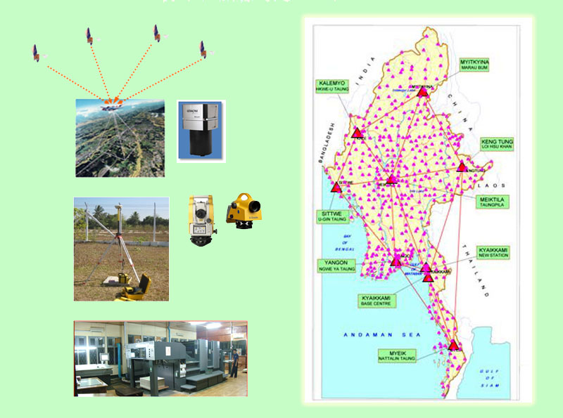
From 1905 to World War II , under the British rule, all the surveying works of Myanmar were undertaken by the Survey of India. At the end of World War II, the British government separated surveying works of Myanmar from Survey of India. On 1st November 1946, Burma Survey Department was formed under the Ministry...

Survey Department mainly takes responsibilities for topographic mapping throughout the whole country and jointly carries out boundary demarcation works with neighboring countries.
The following are the main functions of the Survey Department.
(a) Pr...
Survey Department produces the following maps.
(a) UTM Map (1 : 50,000 Scale)
(b) UTM Map (1 : 100,000 Scale)
(c) UTM Map (1 : 250,000 Scale)
