မြန်မာဘာသာ
 Myanmar - Bangladesh Boundary
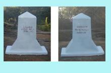
The demarcation of Myanmar- Bangladesh Boundary was done during the year 1979 to 1982, the surveying of 7 boundary pillars and 7 points of mid stream of Taungbro chaung were performed during 1996-1997 field season and the joint inspection of the total length of 218 miles of Myanmar – Bangladesh boundary were carried out during the 1997-1998 field season. The inspection and construction of iron boundary reference pillars were done at Naff river sector during the 2004-05 field season. In 2007-08 fieldseason, the inspection of five send bank occurring in Naff Boundary River was done. The demarcation of the alinement of 150 feet from boundary line between BP- 32 to BP 54 was done in 2009-10 field season. Joint inspection and construction of 2 boundary pillars and the construction of 18 addition boundary pillars and the demarcation of the alinement of 150 feet from boundary line between BP- 54 and BP 67 were done during 2010-11 field season. Joint inspection and construction of 3 boundary pillars and the construction of 14 addition boundary pillars, 19 additional boundary reference pillar and 54 auxilary pillars were done during the 2011-12 field season. Joint Inspection and Restoration of (5) Boundary Pillars, Construction of (21) Additional Boundary Pillars and (26) Reference Markers (RM) along Myanmar-Bangladesh Land Boundary was carried out during 2014-2015 field season.