ပြည်ထောင်စုသမ္မတမြန်မာနိုင်ငံတော်အစိုးရ
သယံဇာတနှင့်သဘာဝပတ်ဝန်းကျင်ထိန်းသိမ်းရေးဝန်ကြီးဌာန
မြေတိုင်းဦးစီးဌာန
တိကျမှန်ကန်မြေတိုင်း“စံ”

 မြန်မာဘာသာ
 Training and No.(1) Survey Division
Training and No: (1) Survey Division
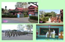
Background
Training and No: (1) survey Division is formed with two sub -divisions. These are Training sub-division and No: (1) survey sub-division.
Background History of Training sub-division (Myanmar Survey Training Center)
Before the World War I, after occupying the Myanmar, the training of district Supdt: of Land Record were opened at Dehradum in India and posted the trainees there to study the land survey subject.
After World War I, the land survey school of Myanmar was opened under the control of land revenue and land survey department in 1918. It was also called special survey school and located at Kamayut Township, Yangon. It distributed the director of the district study.
After that the trainees from that school led and opened the land survey school in each district. Mr. J.C Kalin, Assistant Supdt: of Land Record was the chief of all land survey schools of each district.
There were 30 trainees in each school at this time. When there was less the post of respective department, some schools were cancelled at 1922 and left the 5 districts school. These are Mawlamyine, Kyaukse, Shwebo, Minbu and Pyay.
In 1927, the schools of Mawlamyine, Kyaukse and Minbu were also closed cause of this circumstances were not enough the trainers. Again in 1934, Pyay district was cancelled and there was left Shwebo district school. There was only land survey school in Shwebo and called special survey school with 98 trainees. Head of the school was district director and opened till 1942.
All these schools were closed in 1945 and reopened in 1947. In 1923, the training of Member Course started at Shwebo special land survey school. Supdt; of Land Records Mr. W.E Bell was the first officer-in-charge of No:1 surveying association and he carried out since 1948.
The board of Myanmar exam had to check the writing test of the Basic Survey course and the oral test and practical tests had to be performed by the Supdt: of Land Record from 1948 to 1967. These exams were carried out by the survey school (Training sub-division) of Pyin Oo Lwin and passed out many trainees since 1968 to up to now.
Background history of No: (1) survey Sub-division
No: (1) survey Sub-division was established as No:(1) survey Party on 1st October 1947. This was temporary and director D.E.O. THACKWELL Major, R.E controlled this group.
Building of those was from the age of colony and present building of Pyin Oo Lwin is under control building of India and it was the SURVEY OF INDIA military building.
In 1st October 1947, the survey of India was reformed from the officials from the Shwe Bo Special Survey and formed as No: (1) survey Party.
Formation
Training and No(1) survey Division, Pyin Oo Lwin are formed as follow. There are two sub- divisions and formation are as follow.
Formation of Training sub-division (Myanmar Survey Training Center) is as follow-
(a) Principle - Director
(b) Vice- principle - Deputy Director
(c) Chief of the Training - Assistant Director
(d) Chief- instructor - Staff Officer
(e) Demonstrator - Junior Staff Officers
(f) Warden - Staff Officers and Junior Staff Officers
Principle of Myanmar Survey Training Center
The followings are the principles of Myanmar Survey Training Center after getting the independence.
|
Sr.No: |
Name |
Position |
Offical Year |
|
1. |
MAJOR THACK WELL |
Director |
1947 – 1948 |
|
2. |
U Ba Chit |
Director |
1948 – 1949 |
|
3. |
MR. H.K.KARN |
Officer - in - charge |
1949 – 1950 |
|
4. |
MR. W.E. BELL |
Officer - in - charge |
1950 – 1951 |
|
5. |
U Hla Khin Maung |
Officer - in - charge |
1951 – 1953 |
|
6. |
U Aye Thwin |
Officer - in - charge |
1953 – 1956 |
|
7. |
U Ko Gyi |
Officer - in - charge |
1956 – 1967 |
|
8. |
U Than Nyunt |
Officer - in - charge |
1967 – 1973 |
|
9. |
U D Aung Yi |
Officer - in - charge |
1973 – 1977 |
|
10. |
U Mya Thein |
Officer - in - charge |
1977 – 1983 |
|
11. |
U Thein Htay |
Officer - in - charge |
1986 – 1988 |
|
12. |
U Thein Lwin |
Director |
1988 – 1996 |
|
13. |
U Nyi Htoo |
Director |
1996 – 2001 |
|
14. |
U Soe Than |
Director |
2001 – 2003 |
|
15. |
U Than Hlaing |
Director |
2003 – 2004 |
|
16. |
U Zaw Winn |
Director |
2004 – 2009 |
|
17. |
U San Maung |
Director |
2009 – 2013 |
|
18. |
U Than Kyaw |
Director |
2013 – 2016 |
| 19. | U Kyaw Htay | Director | 2016 - Up to Now |
Organizational Structure and Manpower
The organizational structure and strength of staff capacity at the end of March, 2024 are as follow.
Organizational Structure

Manpower
|
|
Strength |
Posted |
Vacancy |
|
Officers Other Ranks |
14 277 |
12 80 |
2 197 |
|
Total |
291 |
92 |
199 |
Objectives
(1) To teach the survey techniques that follow up the international level.
(2) To intent to be the skill of survey have to reach the international level.
(3) To measure and design the project that for the national building programme.
|
Director |
Tasks of Training and No. 1 Survey Division
Worked out Tasks
In 2013-2014, the tasks that have been finished during the financial year (from April, 2013 to March 2014) are as follow;
Training sub-division (Myanmar Survey Training Center)
- 2013- 2014 academic year; opening the survey officer course, intake (49); Advanced
survey course, intake (61); Basic survey course, intake (72); and theodolite training
course, intake (35)
- The trainees from survey officer course, intake (49), Traverses Circuit map of 5
sheets (498.98 acres).
- The trainees of advanced survey course, (61) intake and basic survey course, (72)
intake took operations that measure of the cadastral surveying for 18 field maps
(7763.15 acres) at Madaya and Singu townships in Mandalay Region.
No: (1) Survey sub-division
- Base on the 1:50,000 scale UTM revised map, compare and check the differences
on UTM map no:1594, 1694,1595, 1695, 1795, 1895, 1995 and 2095 of 1:100,000
and 1: 250,000 scale.
- The update revision task on 1: 50,000 scale UTM map, make field verification on
(31) sheets in Taninthari Region, (50) sheets in Chin state and Sagaing Region.
- According to surveying of 18 Cadastral surveying map sheets by Basic and
advanced survey trainees from Myanmar survey training center in Madaya township
and Singu township, make field boundary adjustment,fair drawing numbering and
calculating the area.
- Measure the area (396.062 hectare) and making the bordering land post to execute
the first stage of Thilawa special economic zone in Yangon Region.
- Drawing the Topographic Maps by 1 meter contour interval on 31133 acre areas of
three Pyu ancient cities (Beikthano, Sriksetra, Halin)
- Constructing the 80 bench marks and 1st order leveling along the Naypyitaw -
Mandalay Highway.
Tasks that will be carry out
During the financial year (2015-2016) (from April, 2015 to March 2016), following tasks will be carry out.
Training sub-division (Myanmar Survey Training Center)
The training center will carry out the surveying training under the control of the Training and No: (1) survey division.
|
Sr. |
Training Course |
Periods |
Qualification |
Remark |
|
1. |
Officer Survey Training in take (50) |
(12) months |
- Any graduate |
|
|
2. |
Advanced Survey Train- ing in take (63) |
(8) months |
- have to pass the Basic Survey |
|
|
3. |
Basic Survey Training Course in take (74) |
(6) months |
- must pass matriculation exam. |
|
|
4. |
Theodolite Training in take (36) |
(2) months |
- have to pass the Basic Survey |
|
|
5. |
Departmental refresher course |
(1) month |
- internal staff who pass the Basic |
|
No: (1) survey sub- division
- Field work, field verification of 1:50,000 scales UTM maps will be co- operated by
Geodetic and No:(2) survey division with accordance to the instruction of Director
General’s office. In the same way, checking of 1:100,000 scales and 1:250000
scales will be co-operated with together Map Reproduction Division, Yangon.
- Surveying of other planning administration, farmyard, and township land plan will
be carrying out.
Learning Survey Subject
Not only residential of department of surveying but also the candidates concerning with survey subjects from the department of Settlement and land record department , Nay pyi taw City Development Committee (NCDC),Yangon City Development Committee (YCDC), Mandalay City Development Committee (MCDC), and Development council and Department of Human Settlement & Housing Development attended to the Myanmar Survey Training Center. According to the negotiations of programme of this department other trainees will be attend.
Myanmar survey Training Center was established in 1947 and the year 2014, there are 11970 candidates who had been accomplished this course.
Training course and the candidates who attended are as follow;
|
Sr: |
Training Course |
Governmental Department |
Remark |
||||
|
Survey |
Irrigation |
SLRD * |
Others |
Total |
|||
|
1. |
Officer |
142 |
1 |
348 |
34 |
525 |
|
|
2. |
Advanced |
- |
- |
1907 |
191 |
2098 |
|
|
3. |
Basic |
442 |
22 |
7682 |
401 |
8547 |
|
|
4. |
Theodolite |
363 |
- |
- |
183 |
546 |
|
|
5. |
Refresher |
254 |
- |
- |
- |
254 |
|
|
|
Total |
1201 |
23 |
9937 |
809 |
11970 |
|
* Settlement and Land Record Department
Submitted Subjects to teach
(a) Following subjects are taught by English language in Officer survey training Course.
( 1) Principle of Surveying
( 2) Linear Measurements
( 3) Scale
( 4) Plane-Table Surveying
( 5) Traversing (Theodolite)
( 6) Cadastral Surveying
( 7) Measurement of Area
( 8) Contouring
( 9) Ordinary Levelling
(10) Tacheometrical Surveying
(11) Triangulation
(12) Topographical Surveying
(13) Ground Control Points
(14) Astronomy for surveyors
(15) Theory of Errors
(16) Map Projections
(17) Graticules of Maps
(18) Survey computation and Adjustment
(19) Fair Drawing
(20) Maps origin and grid system
(21) Introductory Lectures on Aerial Survey
(22) Introductory Lectures on Cartography
(23) GPS Observation & Processing
(24) Total Station & Plotting
(b) Following subjects are taught by Myanmar language in Advanced survey training Course.
( 1) Principle of Surveying
( 2) Linear Measurements and its used survey instruments
( 3) Manipulation of theodolite
( 4) Traversing and its computation
( 5) Topographical map surveying
( 6) Detail Surveying
( 7) Area Calculation
( 8) Ordinary leveling
( 9) Map projections
(10) GPS Observation & Processing
(11) Total station & plotting
(c) Following subjects are taught by Myanmar language in Basic survey training Course.
( 1) Principle of Surveying
( 2) Manipulation of Survey Instrument
( 3) Scale (Linear scale, Diagonal scale, Offset scale)
( 4) Construction of diagonal scale and its usage
( 5) Fair Drawing
( 6) Chain Surveying
( 7) Plane Table Surveying
( 8) Computation and Adjustment
( 9) Detail Surveying
(10) Area Calculation
(11) Map projection
(12) Hand Held GPS observation & Plotting
(13) Total station & plotting
Instruments, Hardware and Software
Survey Instrument used in Training and No:(1) Survey Division
- T-2 (Micrometer type theodolite)
- Kern Auto level
- Nikkon NiVo 1C Totation
- Trimble M-3 Total station
- Trimble 5800/R-8 Geodetic GPS Receiver